Local Natural Areas & Parks
This list includes sites owned and managed by a variety of agencies. Please refer to the included websites for details, including directions, habitats, and park ordinances. The numbered sites are suggested areas from the local committee. The mileage shown is the straight line distance from the convention center, actual travel may be longer. The numbers correspond to the locations on the map. The red star is the convention center.
-
St. Paul Parks
1 Crosby Farms Regional Park – 4.5 miles
2 Lilydale Regional Parks – 2.5 miles
-
Minnesota Valley NWR
3 Bloomington Unit and education center – 8.5 miles
-
State Parks
4 Fort Snelling State Park – 5.5 miles
5 Afton State Park – 16 miles
-
Dakota County Parks
6 Lebanon Hills Regional Park – 12 miles
7 Spring Lake Park Reserve – 15 miles
-
Three Rivers Park District
8 Mississippi Gateway Regional Park – 17 miles
9 Murphy-Hanrehan Park Reserve – 22 miles
10 Crow-Hassan Park Reserve – 32 miles
-
Mississippi National River Recreation Area (MNRRA)
MNRRA does not own accessible land but partners with other agencies along the river. They have an educational area in the Science Museum of Minnesota.
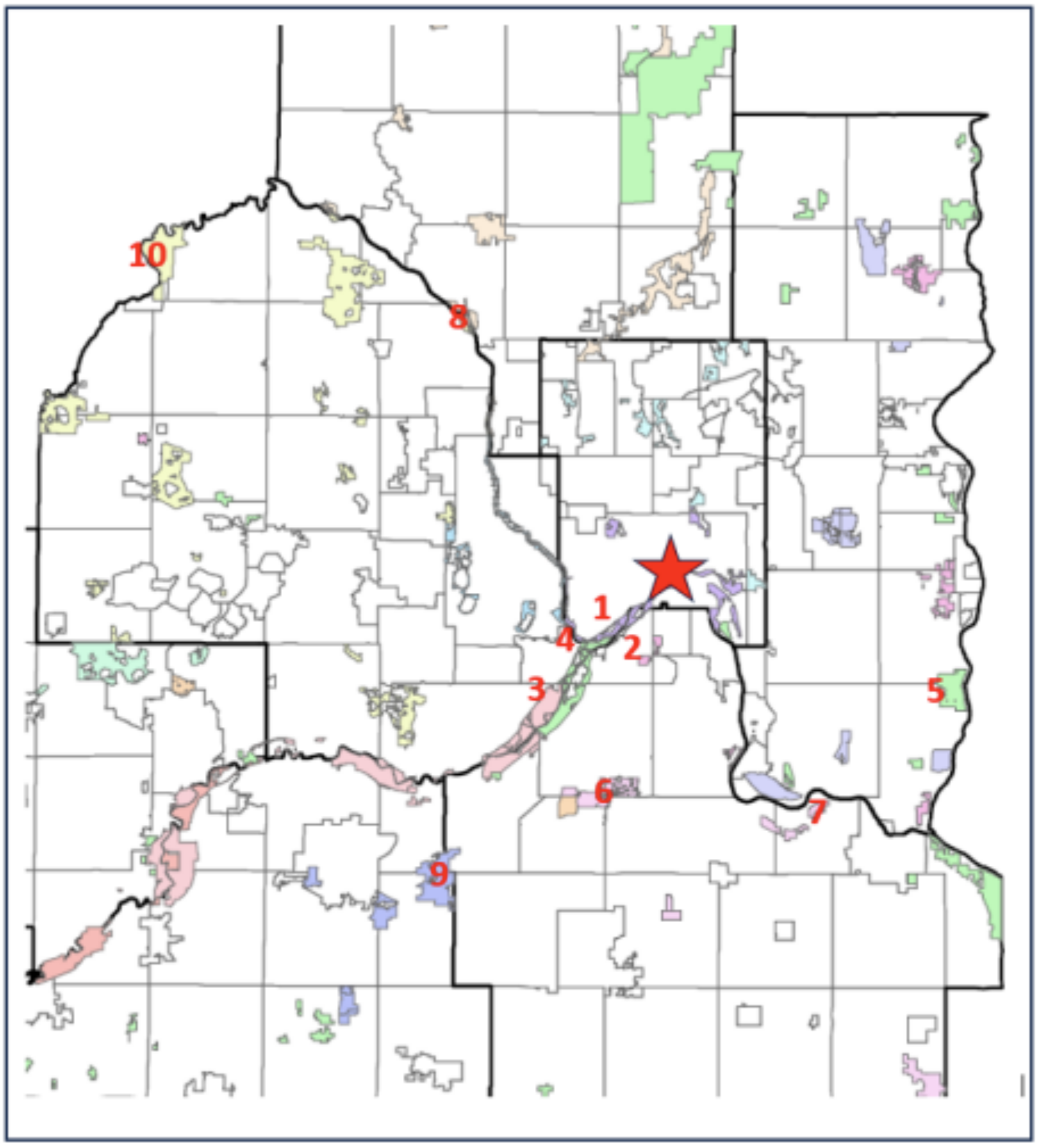
Map showing the location of the natural areas and parks listed on the left.
Attendees wanting to check out other areas within the metro region prior to coming to St. Paul can find additional sites with maps in Field Guide to the Natural World of the Twin Cities (Moriarty 2018, University of Minnesota Press)
Kayak the Mississippi
Use code HELLOMN25 with Paddle Bridge Kayak Tours for 15% off any tour. Their kayak experiences are ideal for families, teams and peers just looking to catch up. Book a tour for any of their availabilities with the promo code right on the website or inquire for private group tours and rates. They offer shuttle services!